Bolsward
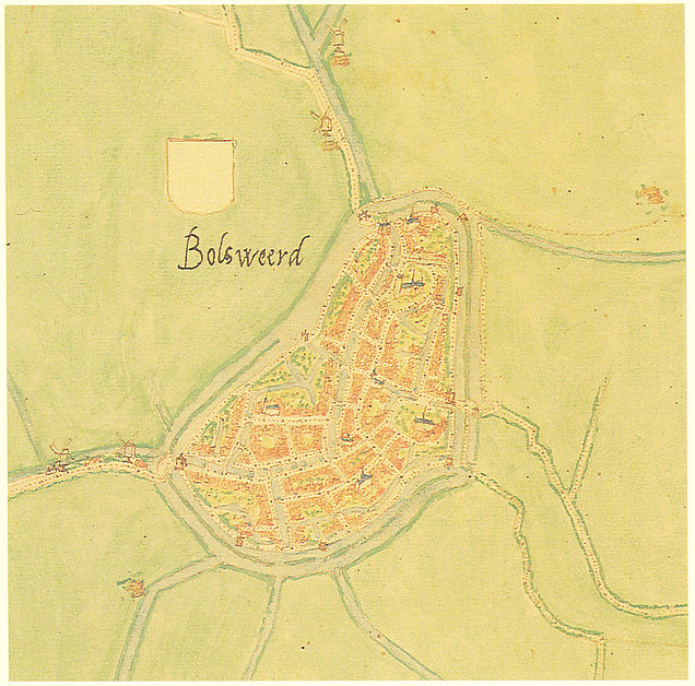
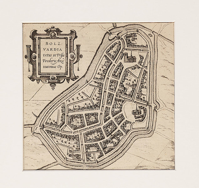
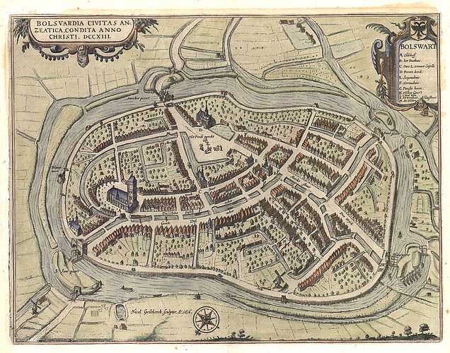
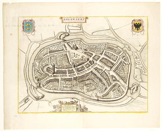
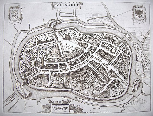
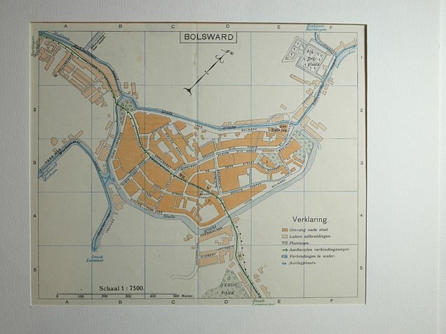
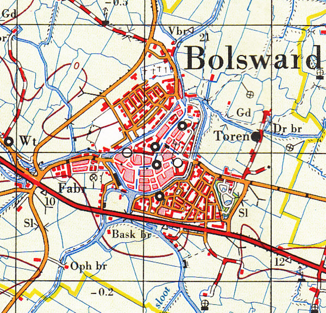
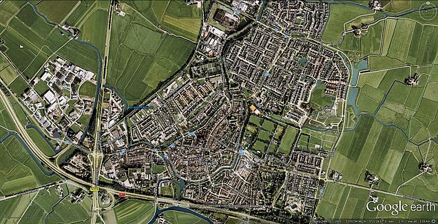
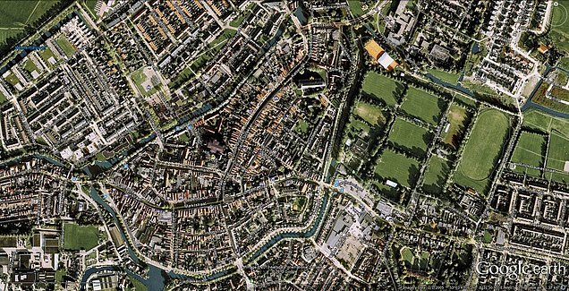
As Bolsward was part of the Hanseatic League, maps of the city were made at a pretty early date already. Oddly enough, historic maps seemed to have a tendency of displaying Bolsward upside down, South up, which is clearly visible in some of the examples below.
Some of these maps are available in much bigger versions, which have a "Show...(original size)" link to download them.
To the left Bolsward in 1561. The North is up, so the Blauwpoort is to the left. This map is from the Van Deventer city maps.
To the right Bolsward in 1585. Blauwpoort is to the left again, so North is up. This is part of a bigger map that also featured Stavoren, Harlingen and Hindelopen. This map was based on the Jacob van Deventer maps, now done by Braun and Hogenberg.
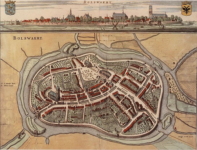
The orientation is the same at the 1649 one. In fact both maps look rather similar. The map is from "Elf reproducties van Friese stadsplattegronden uit de Beschrijving van Heerlijkheydt van Friesland door Bernardus Schotanus a Sterringa". Grootzand also has a name now - "'t Sandt" ("the sand", but no difference for both sides of the water which are named Grootzand and Kleinzand today).
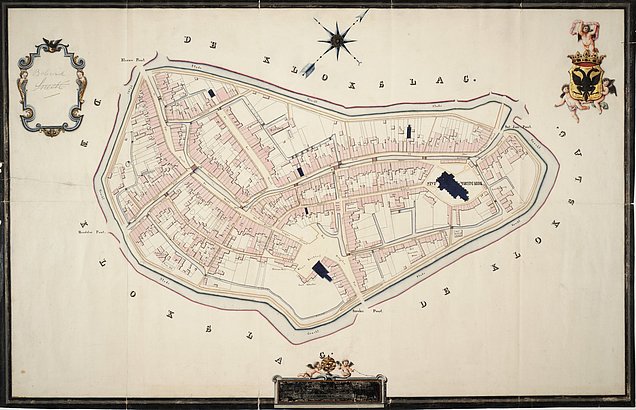
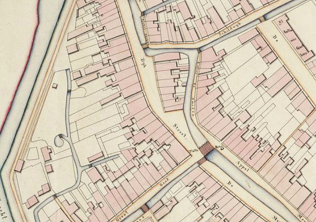
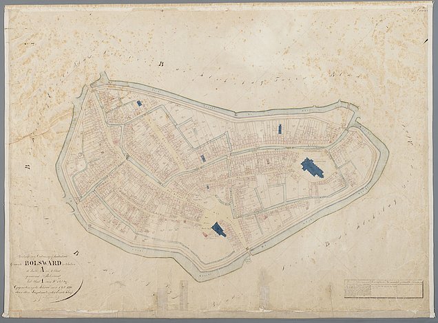
Bolsward in 1820 or 1830, based on work by G.J.J. Rameau. Left all of Bolsward, to the right a detail of the Plantinga-related part of town around Dijkstraat and Grootzand. The North is to the right upwards. Dijkstraat and Grootzand now have the current-day names.There is still a canal running through the Dijkstraat, with little bridges across it.
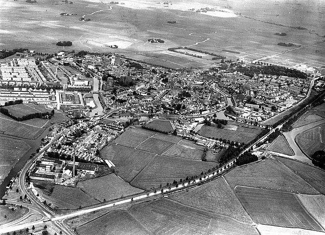
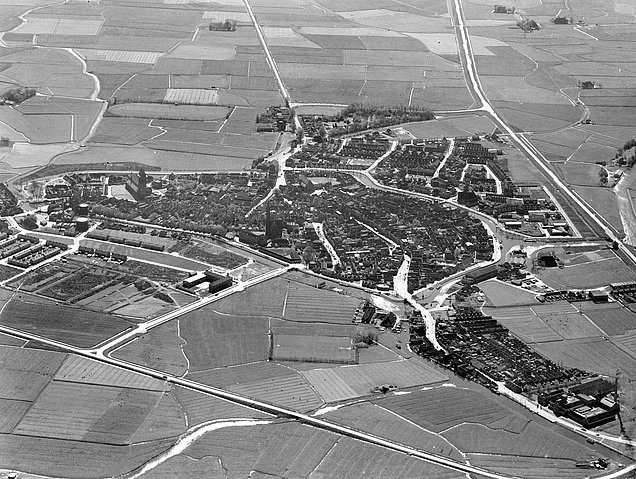
Photo taken from the South, in 1950. In front of the town we see the Rijksweg 43/A7 highway, which had been there since 1940. The water in front of the highway is the Kruiswater, de street lying against that water at the south of the town is the Stoombootkade. Directly North we see three houses. The middle (smallest) house is Stoombootkade 2, where Plantingas lived from 1901 to 1963. Directly to the right, the darkest building, is former hotel Tuininga (later also known as Veldzicht). The water to the right of that hotel is the little canal that separates Grootzand (left) and Kleinzand (right).
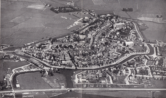
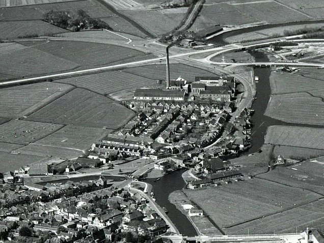
The exact date of this picture is not known, but on the second next picture we see the Gijsbert Japicxlaan (perpendicular to the northern canal) and the Twibaksdyk (from the left centre to right bottom) which are not present here. It does seem like the Japicxlaan is in the process of being lain on this photograph.
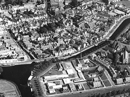
At the bottom right we see the Gijsbert Japicxlaan, which is now clearly finished. This picture primarily shows the Hollandiawijk, in the centre, including the factory with its chimney stack. The photo was taken in a South-Westerly direction. From the left bottom to the centre we see the Dijkstraat. The Plantinga shop might be just at the left edge of the picture.
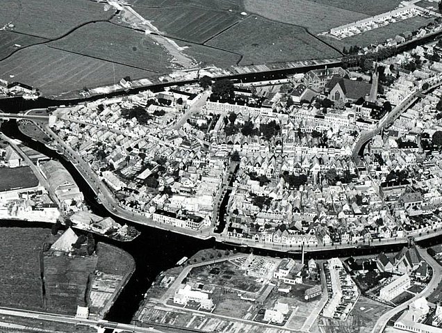
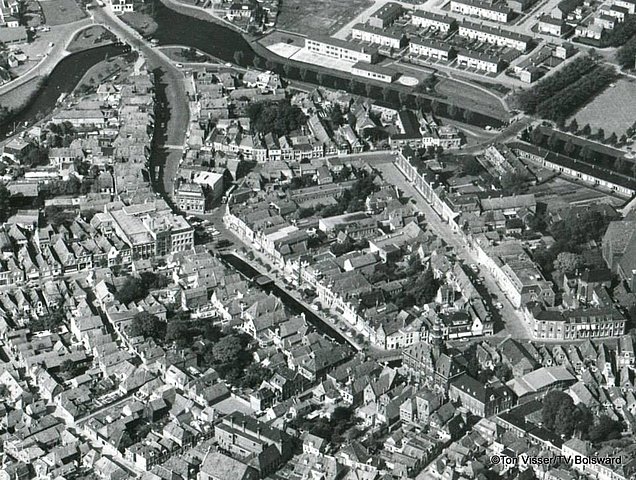
View across Bolsward from the west, now with the A7 to the right, taken between 1955 and 1960 probably. The most eye-catching street into which we're looking head-on is the Dijkstraat. To the left, outside of the canals, a new neighbourhood is being built, Plan Noord ("Plan North"). The neighbourhood to the right buttom (Hollandiawijk) had already been built before World War I, but was invisible on most of the above photos. In the back of the picture, i.e. to the East of the town, we see the Julianapark, which had been planted in 1913.
These three pictures are probably from the same session (the same ships can be seen docked at the Stoombootkade and in front of the Gasthuissingelbrug). They are definitely from after January 1963, because that is when Café "White Corner" burned down. "White Corner" was the name of the previous hotel Tuininga/Veldzicht after it had been bought and refurbished by Heeringa in August 1953 (oh, and painted white). Only the ground floor is still partly upright, at the corner of Grootzand and Stoombootkade.
The first picture was taken from almost due South, the second from the South-West, the last from practically due East.
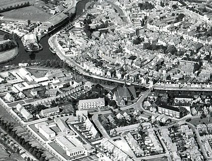
Another picture, taken from the South-West, again after the January 1963 fire (you can still see the rubble from the ground floor). There are others ships in the canal, so this is another session. It can clearly be seen that Plan Noord has grown bigger than on an earlier picture. It now also boasts a tree-lined football field for local football club R.E.S. (Rjucht En Sjlucht).
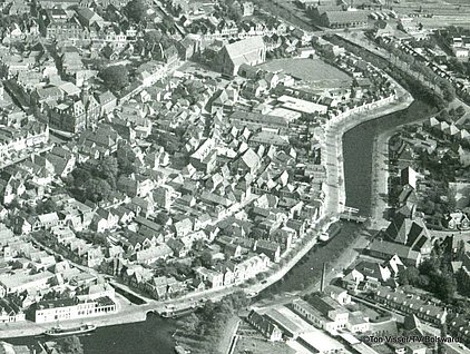
Another photo from around that time. It must be from after 1961, because that is when Hotel "De Wijnberg" got a large cube-like addition to its rear. We can also discern many of the fronts of Grootzand houses (from the centre left to the picture centre). Somewhere between the '50s and and 1976, Grootzand numbers 8 and 7 had big ground floor garage doors. In this picture, the size of Plan Noord has not yet reached the extent of 1975 (below).
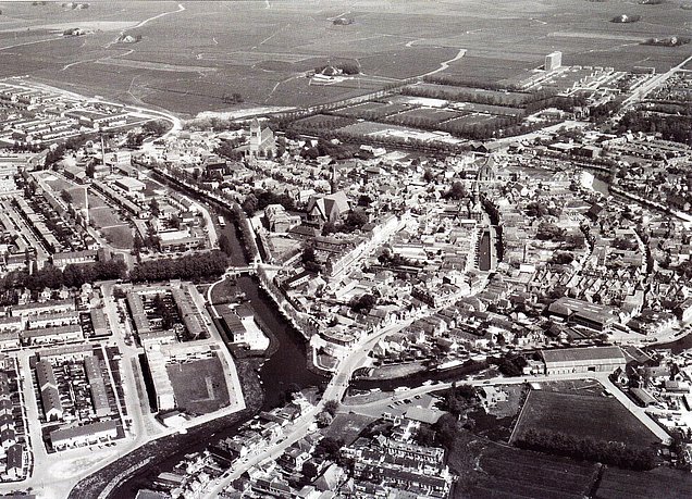
Taken from about due West, in 1975. In the rear we see the only highrise flat in Bolsward, the Boudewijnflat from 1971. Plan Noord, again to the left on the picture, had been extended further. The football field has been removed, as has the Heechhoutboerderij (High Wood Farm) that had been exactly in line with the Dijkstraat, outside the canal in the West. At the far left (i.e. North-East) we see another new neighbourhood. The sports fields are now in the back of the centre of the picture, in front of the Boudewijnflat.
Nice detail: Almost at the right edge of the photo, under the centre, there is an articulated lorry on premises of the Sonnema/Plantinga distillery main location at Stoombootkade 12, which had been opened in May 1971.
Voor het dateren van deze afbeeldingen zijn diverse bronnen gebruikt:
Fries Fotoarchief
Stichtings Bolswards Historie
Serc.nl (website die al jaren oude foto's van Nederlandse gemeenten verzamelt)
Tonnie Siemonsma (een enthousiast Bolswarder/fotograaf)
Tresoar (Friesch Historisch en Letterkundig Centrum)
"Bolsward van Toen" van Piet Prins (tussen 1966 en 1984)
"Bolsward zo was het" van Babs Haanstra (2000)
"Bolsward Ouderdom met Gratie" van W.H. Keikes (1951)
"Bolsward Veranderd Gezicht 1900-1983" van Henk Kapma (1983)
"Geen Monument, toch Onmisbaar" van Stichtings Bolswards Historie (1981)
"Het Oude Bolsward" (vier delen) van J.J. Wijma & J.B. Elzinga (1977, 1983, 1994, 2009)
"Uit het Album van Bolsward" van Mulder, Veerman-Mol en Andringa (1993)
Behalve deze bronnen, ook dank aan Peter Mulder voor het ter beschikking stellen van afbeeldingen.
Indien u de datering kunt verbeteren (b.v. een ansichtkaart met een oudere poststempel, kennis van bouw/renovatie data, etc.) hoor ik dat heel graag. Ook grotere/scherpere versies van bovenstaande afbeeldingen zijn van harte welkom.
